Starting Tuesday, Aug. 6, pavement maintenance will begin on the southbound lane of Finfeather Road from the intersection of S. Bryan Avenue and Beck Street to the intersection of Turkey Creek Road and W. Carson Street.
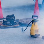
Contractors with City of Bryan’s Water Services will perform smoke testing of sanitary sewer lines intermittently throughout July and August, starting Monday, July 22. Testing is dependent on dry weather and may be postponed due to rain.
Travis Major Field, also known as Edible Field, is owned by the City of Bryan and is currently in an exclusive facility use agreement with Infinity Sports Entertainment, LLC that started in 2006.
Starting Monday, July 8, pavement maintenance will begin on East 29th Street from Briarcrest Drive to the southern city limits near Circle K. Repairs are expected to take one to two weeks, weather permitting. The road will remain open, but drivers should anticipate slight delays.
Our Parks and Recreation Department maintains 51 parks that span over 870 acres, including cemeteries, and over 40 miles of walking trails, not to mention various facilities and programs.
A briefing for individuals interested in running for office in the November 2024 city general election will be held Tuesday, June 25, at 5:30 p.m. in the Council Chamber of Bryan City Hall.
William J. Bryan Parkway will be closed from N. Baker Avenue to N. Haswell Drive from 7 a.m. to 7 p.m. beginning Monday, June 17. Starting at 7 a.m. on June 20, Union Pacific Railroad’s contractors will be repairing the crossings at 28th Street and Bryan Avenue, and Parker Avenue and 27th Street.
Organizations and community members who have a program or project designed to elevate the arts, culture, and tourism in our community are invited to apply for Arts and Culture Development Grant by July 8.
Several roadways in Bryan are now safer for motorists during heavy rainfall with the flood early warning system installment, thanks to a grant received from the state Flood Infrastructure Fund (FIF).
FIF was approved by Texas voters in 2019 and is administered by the Texas Water Development Board (TWDB), the Texas Department of Emergency Management, and the Texas General Land Office. The city received a $180,000 grant to help fund a $450,000 project to install a flood early warning system. This system employs a suite of high floodwater alert sensors for 20 flood-prone roadways in the community.
The flood early warning system alerts emergency response crews and city staff to coordinate preemptive roadway closures. It also warns drivers to “Turn Around, Don’t Drown” with automated flashing beacons. Long-term plans include sending out closure notifications by text/email subscriptions.
City staff utilized historical road closure data to pinpoint locations for implementing the system. These locations ranged from heavily traveled roadways to residential streets that experience flooding during moderate to heavy rains.
Locations:
Old Reliance Road at Carters Creek near Pointe Du Hoc
Hooper Street and Castle Avenue
Bullinger Creek Drive at Carters Creek near Austin’s Colony Park
Boonville Road and Briarcrest Drive
Copperfield Drive at Hudson Creek (north of Boonville Road) near Williamsburg Drive
Copperfield Drive at Hudson Creek (south of Boonville Road) near Coppercrest Drive
29th Street at Burton Creek near N. Rosemary Drive
Tanglewood Drive at Burton Creek near Carter Creek Parkway
Barak Lane and Oak Ridge Drive
Broadmoor Drive at Briar Creek
Burton Drive at Burton Creek near Willow Bend Drive
E. Villa Maria at Burton Creek near Maloney Avenue
W. Carson at Burton Creek near Truman Street
Richard Street and Mockingbird Road
Sandy Point Road at Still Creek near the Brazos Detention Center
Sunders Street at Still Creek near Bruin Trace
Mumford Road at Thompson’s Branch near Capitol Parkway.
Tennessee Avenue and Wilkes Street
E. William J. Bryan at Sue Haswell Park
E. MLK at Carters Creek near N. Earl Rudder Freeway.
In addition to enhancing safety, the sensors collect rainfall data that will be used to help guide decisions about stormwater-related capital improvement projects and assess how development impacts stormwater flow downstream.
We encourage individuals to continue to exercise good judgment when driving in heavy rain. It is never safe to drive or walk into floodwaters, and one should never drive around barricades blocking a flooded roadway.